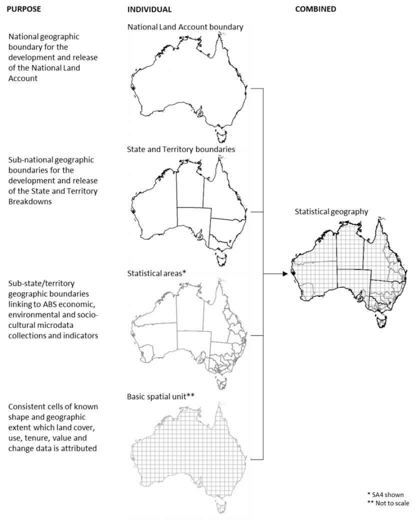
The choice of data sources for land cover, use and tenure was negotiated through key data providers as well as what was deemed to be sufficient quality for use in land accounting. The main data sources were:
- DEA (Geoscience Australia) – land cover estimates
- National Scale Land Use data (ABARES) – land use, land tenure
- National Balance Sheets (ABS) – monetary asset account
DEA land cover and associated land cover change
Geoscience Australia (GA) is Australia’s trusted public sector geoscience organisation and home to Digital Earth Australia (DEA). The DEA platform uses spatial data and images recorded by satellites orbiting our planet to detect physical changes across Australia.
The DEA land cover project is currently developing a new land cover classification and spatial mapping for Australia. The classification is based on the Food and Agriculture Organisation (FAO) Land Cover Classification System (LCCS, version 2), a globally accepted land cover classification standard, with spatial mapping utilising the Landsat time series from 1987 to 2020. The spatial mapping will provide annual land cover classes across Australia, as well as identifying areas of land cover change. When released, the spatial products will be in raster format with a 30m resolution and be available in calendar and financial year variations for 1987 to 2020.
To support the National Land Account, the focus of the DEA land cover project has been to produce annual classification and change (version 1) spatial products for the calendar years 2010 and 2015. The spatial products have been resampled to a 250m resolution to be consistent with the chosen Basic Spatial Unit (BSU) raster format as required in the National Land Account data standards and statistical geography.
ABARES land use and associated land use change
The ABARES is the research arm of DAWE. ABARES works in partnership through the Australian Collaborative Land Use and Management Program (ACLUMP) to develop nationally consistent land use information for Australia. This work is overseen by the National Committee for Land Use and Management Information (NCLUMI).
ABARES is leading the development of a revised methodology for mapping national land use, that allows for change detection analyses, with improved spatial resolution. The spatial mapping utilise the nationally standardised Australian Land Use and Management (ALUM) Classification (version 8), jurisdictional land use spatial products and agricultural commodity modelling based on the ABS Agricultural Census. The spatial mapping will provide 5-year interval land use classes across Australia, as well as identifying areas of land use change. When released, the spatial products are in raster format with a 250m resolution and be available in financial year variations for 2010-11, 2015-16 and 2020-21.
To support the National Land Account, the focus of the ABARES land use project has been to produce annual classification and change (version 1) spatial products for the financial years 2010-11 and 2015-16. The spatial products are consistent with the BSU raster format as required in the National Land Account data standards and statistical geography.
ABARES land tenure and associated land tenure change
ABARES is also leading the development of a new methodology for mapping national land tenure, following the discontinuation of the Public Sector Mapping Authority (PSMA) national land tenure spatial products (now Geoscape). The new methodology and national classification are based on the ABARES Tenure of Australia’s Forests spatial products and classification, modified to reflect additional jurisdictional tenure legislative instruments. The spatial mapping will provide 5-year interval land tenure classes across Australia, as well as identifying areas of land tenure change. When released, the spatial products will be in raster format with a 250m resolution and be available in financial year variations for 2010-11, 2015-16 and 2020-21.
